NISAR satellite to map Himalayas’ seismic zones (GS Paper 3, Science and Technology)

Why in news?
- A forthcoming satellite NISAR, will map the most earthquake-prone regions in the Himalayas with unprecedented regularity.
- NISAR satellite was jointly developed by the Indian Space Research Organisation (ISRO) and the National Aeronautics and Space Administration (NASA) of the U.S.
- The data this will generate can potentially give advance warning of land subsidence, as recently observed in Joshimath, Uttarakhand, as well point to places that are at greatest risk from earthquakes.
Frequency bands:
- The NISAR satellite, expected to cost approximately $900 million (with ISRO contributing about one-tenth) will use two frequency bands: the L-band and S-band to image the seismically active Himalayan region that will, every 12 days, create a “deformation map”.
- While NASA has provided the L-band radar, GPS, a high-capacity solid-state recorder to store data, and a payload data subsystem, ISRO (Indian Space Research Organisation) has provided the S-band radar, the Geosynchronous Satellite Launch Vehicle (GSLV) launch system and spacecraft.
- S band radars operate on a wavelength of 8-15 cm and a frequency of 2-4 GHz. Because of the wavelength and frequency, they are not easily attenuated. This makes them useful for near and far range weather observation.
Why NISAR will be used in earthquake-prone regions?
- As per India’s seismic zoning map, the total area is classified into four seismic zones: V, IV, III & II. Zone V is seismically the most active region, while zone II is the least.
- To address that, National Centre for Seismology is undertaking a microzonation exercise. which was already completed for major metros like Delhi and Kolkata.
- This mapping identifies earthquake zones at a more granular level which can help people build structures accordingly.
- The satellites can track small changes in plate tectonics and identify areas where the strain is building up for a potential earthquake.
- Satellite imagery can also help identify where groundwater depletion is causing land subsistence, such an instance was identified recently in an area of Chandigarh. Such an exercise would become more easily possible NISAR spacecraft that will be able to update plate deformation data every 12 days.
Way Forward:
- It is expected to be launched in January 2024 from Satish Dhawan Space Centre into a near-polar orbit.
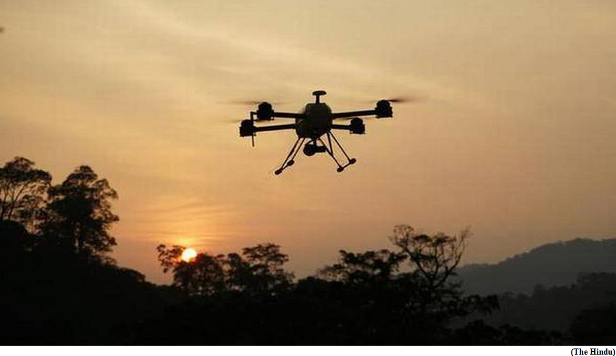
Drones to deliver life-saving drugs to Char Dham pilgrims
(GS Paper 1, Culture)
Why in news?
- Drones will be used to deliver life-saving drugs to Char Dham pilgrims during any emergency.
- Kedarnath, Badrinath, Gangotri, and Yamunotri, all 10,000-ft-high pilgrimage sites in the Garhwal Himalayas will be covered under this.
Background:
- The decision to engage drones to deliver medicines in high-risk areas during an emergency was taken following recognition of the need to offer immediate medical service to those in need.
- There were 120 deaths in just 27 days during the Kedarnath yatra in 2022, according to a study conducted by the Government Doon Medical College in Uttarakhand titled ‘Mortality at the Kedarnath Pilgrimage Trek in 2022: A Possible Interplay between Post-COVID Syndrome and High-Altitude Mountain Sickness’.
Three-layered structure:
- The government is also working on creating a three-layered structure to provide health support and emergency management infrastructure for pilgrims.
- The Ministry was also informed of the health challenges faced by pilgrims along the strenuous route, and the number of deaths in the past few months due to emergencies such as strokes.
- Many of these casualties were pilgrims who suffered from co-morbidities.
Animal Pandemic Preparedness Initiatives and World Bank-funded Animal Health System Support for One Health launched
(GS Paper 2, Health)
Why in news?
- Recently, the Union Minister for Fisheries, Animal Husbandry and Dairying launched the Animal Pandemic Preparedness Initiative and World Bank-funded Animal Health System Support for One Health to enhance India's preparedness and response to potential animal pandemics, in line with the One Health approach.

Aim:
- This initiative aims to enhance India's preparedness and response to animal pandemics, with a focus on zoonotic diseases that pose a threat to both animal and human health.
- This initiative will help to improve veterinary services and infrastructure, disease surveillance capabilities, early detection and response, build the capacity of animal health professionals, and awareness among farmers through community outreach.
AHSSOH:
- The event also saw the launch of the World Bank-funded project on “Animal Health System Support for One Health (AHSSOH)” that aims at creating an ecosystem for a better animal health management system using the One Health approach covering five (05) states in India.
Animal Pandemic Preparedness Initiative (APPI):
- Animal Pandemic Preparedness Initiative is an initiative to cover all aspects of disease prevention, control and pandemic preparedness comprehensively.
- The key elements include Integrated disease surveillance & monitoring, early warning & response, Vaccine/ diagnostics, R&D and production, and ecosystem coordination with funding and regulatory framework enablers.
Implementation:
- The Department of Animal Husbandry and Dairying, (DAHD), Government of India is committed to the successful implementation of the Animal Pandemic Preparedness Initiative and the World Bank-funded Animal Health System Support for One Health and looks forward to working with all stakeholders towards this important goal.