Sediments decode climate and environmental changes on Kaas Plateau around 8664 years BP (GS Paper 1, Geography)
Why in news?
- Recently, a new study of the sediments from a seasonal lake in the Kaas Plateau in the Satara district of Maharashtra has indicated a major shift in the Indian Summer Monsoons towards dry and stressed conditions with low rainfall during the Early-Mid–Holocene, around 8664 years BP.
- Sediment profile dating back to 8000 years indicated a relatively reduced rainfall and weak southwest monsoon during the late Holocene (around 2827 years BP).
About Kaas Plateau:
- Kaas Plateau, nestled in the Western Ghats, was included in the UNESCO World Natural Heritage Site in 2012.
- Known as Kaas Pathar in Marathi, its name is derived from the Kaasa tree, botanically known as Elaeocarpus glandulosus (rudraksha family).
- Designated as a biodiversity hotspot, the Kaas Plateau comes to life with various seasonal flowers forming a floral carpet over the entire lateritic crust during August and September.
Basis of the study:
- Agharkar Research Institute (ARI), Pune, along with the National Centre for Earth Sciences, Thiruvananthapuram studied the sediments of a seasonal lake to understand and decipher the past climate of the Kaas Plateau.
- Sediment profile dating back to 8000 years which was analysed (by available carbon dates-AMS) to decode the climatic signatures, indicated that the seasonal lake favoured freshwater accumulation almost for 8000 years before the present (BP) and probably dried sometimes after 2000 years BP.
Key observations:
- The observations from the study revealed that the seasonal lake is probably a product of an erosional localized shallow depression on a pediment (rock debris) developed over the crust.
- It is located on a lake that dates back to the Early-Mid-Holocene period, which means it is an ancient lake that has been preserved over a long time.
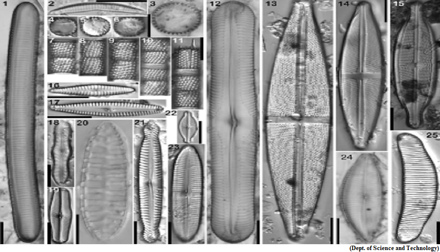
- The signatures of diatoms, mites, thecamoebians, and sediment characteristics provided better resolutions regarding the hydrological processes and modification of the seasonal lake.
- During the early to mid-Holocene, at around 8664 years ago, pollen, as well as diatom data, indicated a change in the climate from freshwater to drier conditions with low rainfall.
- Surprisingly, there was a significant rise in the number of diatoms in between. This suggests a major shift in the Indian summer Monsoon activity during that time, possibly resulting in intermittent humid periods amidst the dry spells.
- The observations of the scientists showed a decrease in rainfall and a weakened southwest Monsoon during the late Holocene (around 2827 years BP).
- However, during the recent past (around last 1000 years), pollen, as well as the presence of a high number of planktonic and pollution-tolerant diatom taxa indicated lake eutrophication, possibly due to human impact and cattle/livestock farming in the catchment.
- It is very likely that the 'Flower Wonder' might have existed for a longer duration, up to March-April, during the early–mid-Holocene (8000–5000 years), when the monsoon rainfall (more than 100 rainy days) was undoubtedly better than today.
Way Forward:
- The findings emphasized the need for conservation measures to protect the site's invaluable natural and cultural heritage.
Chandrayaan 3 launch, How LVM-3 will put India on a journey to the Moon
(GS Paper 3, Science and Technology)
Why in news?
- The Indian Space Research Organisation (ISRO) is set to launch the Chandrayaan-3 mission to the Moon from the Spaceport at the Satish Dhawan Space Centre in Sriharikota.
- The most importance is the powerful LVM-3 rocket that will power the Indian spacecraft on a trajectory to the Moon pushing it beyond Earth's orbit.
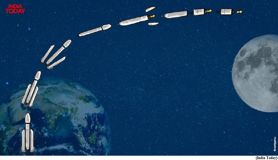
What is LVM-3?
- The LVM3, a three-stage launch vehicle, has been instrumental in launching various satellites and lunar missions in the past.
- Known as the 'Bahubali' of Indian rockets, it consists of two solid-fuel boosters and a liquid-fuel core stage powering it. The solid-fuel boosters provide the initial thrust, while the liquid-fuel core stage provides the sustained thrust to propel the rocket into orbit.
- LVM-3 has been used to launch a number of different satellites in the past, including the GSAT-19 communication satellite, the Astrosat astronomy satellite, and the Chandrayaan-2 lunar mission.
- It is also scheduled to be used to launch the Gaganyaan crewed mission, which will be India's first human spaceflight.
How it works?
First Stage:
- The LVM3's journey begins with the simultaneous ignition of two solid boosters, known as S200 carrying 207 tonnes of propellant in three segments.
- These boosters burn for 127 seconds, producing an average thrust of 3,578.2 kilonewtons and a peak thrust of 5,150 kilonewtons each. This initial thrust propels the rocket into the sky, marking the first stage of the launch.
Second Stage:
- After the solid boosters separate from the launch vehicle, the second stage commences. This stage is powered by the L110 liquid stage, a liquid-fueled engine that contains 110 metric tons of fuel.
- It is powered by two Vikas engines, each generating 766 kilonewtons thrust, giving a total thrust of 1,532 kilonewtons. The L110 core stage ignites 108 seconds after liftoff and burns for 203 seconds, further accelerating the vehicle.
Third Stage:
- Following the separation of the liquid stage, the third and final stage takes over. This stage is marked by the activation of the CE25 cryogenic stage.
- The cryogenic upper stage, designated C25, is 4 meters in diameter and 13.5 meters long and contains 28 metric tons of propellant LOX and LH2, pressurized by helium stored in submerged bottles.
- It is powered by a single CE-20 engine, producing 200 kN of thrust.
Payload fairing:
- The LVM3 also includes an equipment bay and an encapsulated assembly, which houses the spacecraft, known as the Payload fairing.
- The encapsulated assembly is crucial as it contains the Chandrayaan-3 spacecraft, which will be ferried into an Earth parking orbit.
Way Forward:
- The LVM3's design and functionality have been meticulously planned to ensure the successful launch and deployment of the Chandrayaan-3 mission.
The first GSI survey of the Siachen
(GS Paper 3, Internal Security)
Context:
- June-August 2023 marks the sapphire jubilee of a very important event in the history of the exploration of the Siachen glacier.
- The grid reference point NJ 9842, the last mutually demarcated point between India and Pakistan as per the Karachi ceasefire agreement of 1949 and also the point 5Q 131 05 084 where the Line of Control of the Simla Agreement ends, is the number assigned to the Siachen glacier by the Geological Survey of India (GSI).
The first Siachen survey:
- In June 1958, V. K. Raina, a top Indian geologist, who at that time was an Assistant Geologist with the GSI led the first GSI Survey of the Siachen glacier.
- In 1956, he had been a part of the Saser Kangri expedition conducted by the Himalayan Mountaineering Institute of Darjeeling. During this time, he studied the geology and geomorphology of the Nubra Valley upto Panamik. Thereafter, in 1957, he was involved in the geological survey of the alignment of the proposed Leh-Manali Highway which was only a mule track at that time.
International Geophysical Year 1958:
- 1958 was an important year for geologists all over the world as it was celebrated as the International Geophysical Year.
- The GSI proposed to conduct a study of the Himalayan glacier systems which included snout monitoring of the glaciers in the Sikkim Himalayas, Kumaon Himalayas as well as the Kashmir Himalayas.
- The responsibility of snout surveying five glaciers in the Ladakh region was given to him. These were the Siachen, Mamostong, Chong Kumdan, Kichik Kumdan and Aktash glaciers.
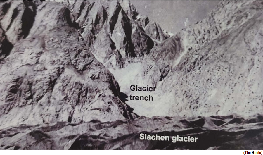
First Glimpse:
- In August/October 1958 the Siachen glacier exhibited two ice caves which were about 100 metres apart. While the southern cave was visible from the level plateau downstream of the snout, the northern one could only be seen after going high up the eastern wall upstream of the snout.
- The Nubra River could be seen flowing out from the northern ice cave before it disappeared under the glacier ice and emerged out of the southern ice cave.
Pakistan’s nonchalance:
- If during this period Pakistan did entertain any idea of this region falling on its side of the ceasefire line, then it would surely have lodged a protest against it. However, there were no such protests and there is no contemporaneous document to this effect from Pakistan.
- There could be two possible reasons for Pakistan’s general lack of interest in the continued Indian presence on the glacier at that time.
- Firstly, both India and Pakistan were abiding by the terms of the Karachi ceasefire agreement of 1949 under which they had clearly delimited the entire cease fire line right up to the glaciers and agreed to mutually demarcate it.
- Even though the region beyond NJ 9842 was pending mutual demarcation and delineation, it was evident that if the line were to proceed north right till the glaciers as envisaged under the agreement, then this region would still fall on the Indian side.
- Since explorations and scientific visits did not pose any threat or give either side any reason to believe that the other may physically occupy the region contrary to the explicit agreement, not much importance was given to them.
Operation Meghdoot:
- It is only 25 years later that Pakistan for the first time formally staked its claim to this region (contrary to the Karachi ceasefire agreement) by unilaterally extending the Line of Control from NJ 9842 till the Karakoram Pass in its protest notes of August 1983 (contrary to the Simla Agreement).
- This set the alarm bells ringing in India and put into motion a chain of events which resulted in India pre-empting Pakistan and occupying the strategic Saltoro Heights on April 13, 1984.