Why is the 1.5 degree Celsius target critical? (GS Paper 3, Environment)
Why in news?
- Recently, the World Meteorological Organization (WMO) released two reports titled, “Climate Update 2023-2027” and “State of Global Climate 2022.”
- The decadal predictions of the WMO said that the annual mean global surface temperature between 2023 and 2027 will be 1.1-1.8 degree Celsius higher than the baseline temperature of 1850-1900 or pre-industrial levels.
- In 2022, it was 1.15 degrees above the baseline, and by 2027, the average will exceed 1.5 degrees, a critical point beyond which there may be no return.
What is the 1.5 degree Celsius target?
- The 1.5 degree Celsius target is the global climate target that aims to limit warming to said level by 2100, in order to prevent the planet from slipping into further climate crises. For decades, 2 degree was an acceptable level of warming.
- The idea of 1.5 degree was perceived as unrealistic and unachievable. However, the 2 degree target was unacceptable to small island countries as it implied that their survival was compromised.
- In 2010, at the Cancun COP16, countries agreed to limit the global average warming to below 2 degree Celsius. In 2015, the parties to the Paris Agreement pledged to limit the average temperature rise to below 2 degree, while actively aiming for 1.5 degree above pre-industrial levels.
- This was endorsed as a global target by the Intergovernmental Panel on Climate Change (IPCC) in 2018 and since then has been pursued in all climate dialogues.
Why is the 1.5 degree target critical?
- In 2018, the IPCC released a special report on the impact of global warming when temperature reaches 1.5 degree Celsius above baseline. It also drew a comparison with the effects of 2 degree Celsius warming.
- It was estimated that anthropogenic activities would have already caused 1 degree of warming, likely to reach 1.5 degree between 2030 and 2052 at the current rate.
- Frequent and intense heat waves, droughts, heavy precipitation, an additional 10-centimetre rise in sea level, destruction of ecosystems and mostly irreversible changes can be witnessed at the 2 degree level.
- However, discussions on the average temperature rise do not imply that the current warming is uniform across the planet. For example, warming greater than the global average is being experienced in the Arctic, with the term ‘polar amplification’ gaining more traction.
- The regional differences and the vulnerability factors spell more urgency for climate action which must limit the average planetary warming to 1.5 degree.
Are extreme weather events linked to the global rise in temperature?
- The predictions of the recently released reports point to precipitation anomalies and an increase in marine heat waves as compared to marine cold spells. The El Niño, which is currently brewing, will further strengthen this year, resulting in a 98% possibility of witnessing temperatures higher than 2016 at least in one of the years in the 2023-27 period.
- The cryosphere is shrinking, and there is a mass loss of glaciers in High-mountain Asia, Western North America, and South America. Due to the alarming rate of warming of the Arctic Ocean, the Greenlandic ice sheet is melting at a faster pace, contributing to the increase in sea level.
- Climate risks and hazards impact human population and the ecosystem depending on exposure, vulnerability, and adaptive capacity. It has exacerbated food insecurity, displacement, and deaths. Climate change has been affecting crop yield negatively and the risks posed by agricultural pests and diseases have also increased in the past few years. Countries like Ethiopia, Nigeria, South Sudan, Somalia, Yemen, and Afghanistan are facing acute food shortages resulting in malnutrition and hunger, demanding urgent humanitarian assistance.
- However, food insecurity in these countries is due to the complex interaction of climate conditions with other factors such as droughts, cyclones, and political and economic instability.
- Aquatic and terrestrial ecosystems have also not been immune to such changes in climate patterns. Phenological shifts and mismatches have been recorded due to climate change. The population of migratory species has declined in Sub-Saharan Africa.
- Additionally, the warming above 1.5 degree Celsius can prove lethal for coral reefs which are already prone to bleaching.
How is India impacted?
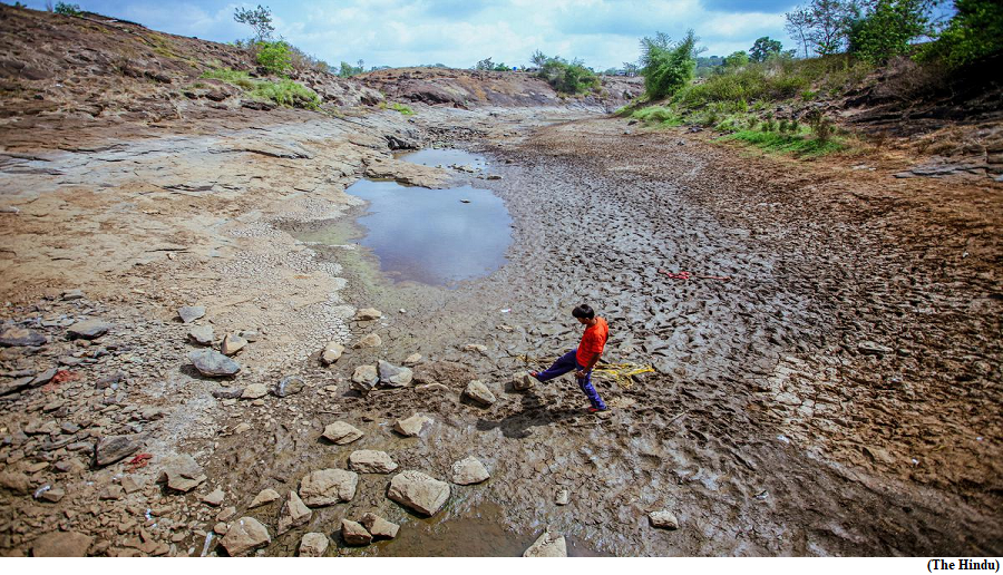
- India has been increasingly facing the brunt of climate change. February 2023 was recorded as the hottest month since record-keeping began in 1901.
- In 2022, India witnessed extreme weather events for 80% of the days. Indian monsoons were wetter than usual last year after recording extreme heat during the pre-monsoon period, resulting in wildfires in Uttarakhand and acute food shortages.
- According to the Climate Change Performance Index 2023, India ranked eighth with a high-performance after Denmark, Sweden, Chile, and Morocco. Being an emerging economy with development needs, it is attempting to balance its development needs with ongoing climate action both at the domestic and international levels.
- With domestic measures like the Green Hydrogen Mission and the introduction of green bonds, India is performing fairly well despite contributing only a miniscule to cumulative GHG emissions.
- At the international level, through the International Solar Alliance and Coalition for Disaster Resilient Infrastructure, India can prove to be a responsible climate player keeping in mind that it has a long way to go in very little time.
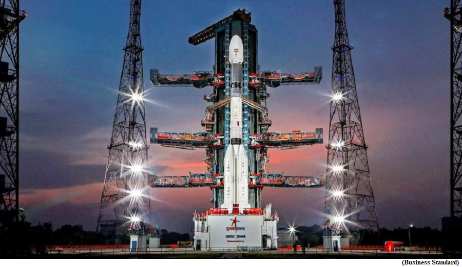
ISRO GSLV F12 successfully places NavIC satellite NVS 01 into orbit
(GS Paper 3, Science and Technology)
Why in news?
- Recently, the Indian Space Research Organisation (ISRO)'s Geosynchronous Satellite Launch Vehicle (GSLV) rocket carrying navigation satellite NVS-01 lifted off from Sriharikota and placed it into orbit.
- With this, ISRO aims to augment the continuity of Navigation with Indian Constellation (NavIC) services with the launch of the satellite.
Details:
- The second-generation navigation satellite series is considered a significant launch that would ensure the continuity of NavIC services -- an Indian regional satellite navigation system, similar to GPS, providing accurate and real-time navigation in the country and a region extending to 1,500 km around the mainland.
- The NavIC satellites are used in terrestrial, aerial, and marine transportation, location-based services, personal mobility, resource monitoring, surveying and geodesy, scientific research, time dissemination and synchronization, and safety-of-life alert dissemination.
- The second-generation satellite would also carry an indigenously developed rubidium atomic clock. Earlier scientists at ISRO had used an imported atomic clock.
Navigational capabilities:
- The NVS-1 is the first satellite of the next-generation NavIC satellite aimed to augment the navigational capabilities of the country.
- The system was developed looking at the growing requirements of the Civil Aviation sector in the country for better positioning, navigation, and timing.
- NVS-01 carries navigation payloads L1, L5, and S bands.
- The network covers an area including India and a region up to 1500 km beyond the Indian boundary. The signals are designed to provide user position accuracy better than 20 meters and timing accuracy better than 50 nanoseconds.
- The NavIC system operates in the L5 band, which is a protected frequency specifically assigned to the Indian system. The NVS-1 being launched now incorporates L1 band signals additionally to widen the services.
What is NavIC?
- ISRO developed the NavIC system to meet the positioning, navigation, and timing requirements of the country, particularly with regard to civil aviation and military requirements.
- NavIC was earlier known as the Indian Regional Navigation Satellite System (IRNSS) and is designed with a constellation of seven satellites and a network of ground stations that operate 24x7.
- It offers two services, Standard Position Service (SPS) for civilian users and Restricted Service for strategic users.
- NavIC SPS signals are interoperable with the US global navigation satellite system signals, GPS, Glonass from Russia, Galileo (European Union), and BeiDou, China.
Way Forward:
- It is the sixth operational flight of the GSLV with an indigenous cryogenic stage. The mission life of NVS-01 is expected to be better than 12 years.
From prevalence in eight States in 2001, dengue now a nationwide infection
(GS Paper 2, Health)
Why in news?
- Faced with a shortage of entomologists, a trickier vector, increased travel, and less than optimal public participation for prevention, the infection geography of dengue, which was restricted to eight States in 2001, currently covers all the States and Union Territories in India.
- Dengue has now breached the country’s last bastion, Ladakh (with two cases in 2022).
Details:
- As the southwest monsoon is on envil, which is associated with the rise of certain diseases, including malaria, dengue and zika, the Indian Council of Medical Research (ICMR) confirmed that dengue’s infection geography has grown.
- During the past two decades, there has been a significant geographical spread of dengue with an 11-fold increase and repeated outbreaks. Rural areas contributed approximately 32% of the total cases in 2015-16 and have increased to 41%-45% now.
Half of world at risk:
- The World Health Organization estimates the global incidence of dengue has grown over recent decades, with half of the world population now at risk.
- This risk from dengue, which is now endemic in more than 100 countries, has been propelled by several factors, including climate change, increased urbanisation and increased travel.
Measures to control:
- The dengue vector is very different from the malaria vector and so, bio-environmental strategies alone will not work. This, coupled with the shortage of entomologists in the country, works to help the spread of dengue.
- Besides the work on vaccines, ICMR is also looking at increasing awareness and promoting prevention, people’s participation, and the use of the latest technology, including satellite imaging and drones to map vulnerable areas.
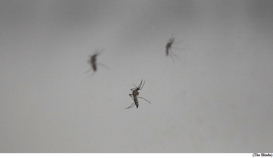
What is Dengue?
- The dengue virus belongs to the family Flaviviridae and has four serotypes: DEN-1, DEN-2, DEN-3, and DEN-4.
- The virus is transmitted to humans by the Aedes mosquito, which becomes infected by biting an infected person.
- Once the virus enters the human body, it replicates in white blood cells called monocytes and macrophages, which are a part of the body's immune system.
- The virus then spreads to other organs, including the liver, spleen, and lymph nodes, causing a range of symptoms.