On Women’s Day eve, Nagaland’s first woman Minister assumes office (GS Paper 2, Governance)

Why in news?
- Ahead of International Women’s Day, Salhoutuonuo Kruse made history by becoming Nagaland’s first woman Minister.
Details:
- The berth in the Nagaland Cabinet led by Neiphiu Rio came five days after she and Hekani Jakhalu were elected as the first women MLAs of the State. Both represent the Nationalist Democratic Progressive Party (NDPP).
- The NDPP and the BJP have a total of 37 MLAs in the 60-member Assembly. Almost all the other 23 MLAs have extended support to the government, making it opposition-less.
International Women’s Day:
- Each year, March 8 is observed as International Women’s Day to celebrate the social, economic, cultural, and political achievements of women from all around the world.
History:
- The concept of International Women’s Day first emerged in the early 1900s. Women’s Day first came into existence in 1909 and it was known as National Women’s Day.
- The day was initially celebrated on 28 February 1909, when 15,000 women marched through New York City demanding shorter hours, better pay, and voting rights.
- Around the same time in Europe, in 1910 to be precise, the second International Conference of Working Women was held in Denmark’s Copenhagen, where Clara Zetkin, who led the Women’s Office for the Social Democratic Party in Germany tabled the idea of an International Women’s Day and on March 9, 1911, International Women’s Day was honoured for the first time in Austria, Denmark, Germany and Switzerland.
- The United Nations (UN) started celebrating International Women’s Day in 1977 and in 1977, it was officially agreed that the day will be widely observed on March 8 every year.
Theme – 2023:
- The theme for 2023 Women’s Day, is “DigitALL: Innovation and technology for gender equality”.
ISRO receives satellite NISAR, jointly developed by India and US
(GS Paper 3, Science and Tech)
Why in news?
- The Indian Space Research Organisation (ISRO) has received the NASA-ISRO SAR (NISAR) satellite. NISAR is a Low Earth Orbit observatory jointly developed by NASA and ISRO.
- The NASA-ISRO Synthetic Aperture Radar (NISAR) has arrived in India after being developed in the US.

Details:
- The spacecraft landed in Bengaluru and has been moved to the UR Rao Satellite Centre for further testing and assembly with ISRO’s satellite bus, moving the Earth science mission a step closer to its 2024 launch from Sriharikota.
- The spacecraft has been designed to have the most advanced radar system ever launched on a science mission to better study natural hazards melting sea ice, groundwater supply, and other environmental factors that are a triggering force behind the rising pace of climate change across the world.
What is NISAR Mission?
- NISAR is a joint Earth observation mission developed by India and the US to better understand the vast climatic changes unfolding on the planet that could cause serious damage in the coming years. The two countries are providing two different radar systems for the mission.
- As part of the mission, NASA is providing the mission’s L-band Synthetic Aperture Radar (SAR), reflector antenna, deployable boom, a high-rate communication subsystem for science data, GPS receivers, a solid-state recorder, and payload data subsystem.
- Meanwhile, India is providing the spacecraft bus, the S-band SAR, the launch vehicle, and associated launch services and satellite mission operations.
What will NISAR do in Space?
- NISAR will be the first such satellite to operate beyond Earth that can systematically map Earth using two different radar frequencies. The spacecraft will observe nearly all of Earth’s land and ice surfaces twice every 12 days, measuring movements with finer details than ever.
- The probe will survey forests and agricultural regions to help scientists understand carbon exchange between plants and the atmosphere.
- It will focus on better analysing natural hazards from small movements building up under the surface of the planet to massive volcanic eruptions. The spacecraft could further help in improved forecasting and mitigation of these hazards.
How does NISAR work?
- NISAR consists of two synthetic aperture radars, which will cover the length and breadth of the planet during its movement in space.
- This system uses a unique way to produce fine-resolution images moving in a straight line. The radar emits an electromagnetic signal toward a surface and records the amount of signal that bounces/echoes back, or “backscatters,” and its time delay.
- The resulting radar imagery is built up from the strength and time delay of the returned signal, which depends primarily on the roughness and electrical conducting properties of the observed surface and its distance from the orbiting radar.
- The spacecraft takes advantage of the fact that it is moving in space to synthesize a virtual 10-km-long antenna from the physical 10-m antenna in the direction of flight.
- NISAR has a 240 km swath, 7-meter resolution along the track and 2-8 metre resolution cross-track, which beats the resolution limits of what can physically be put in space to provide images and science of much higher quality than would be possible if the antenna size was used as is.
- The spacecraft will be launched onboard India's Geosynchronous Satellite Launch Vehicle Mark II (GSLV-MkII) rocket from Satish Dhawan Space Centre in a near-polar Earth orbit.
How did the treaty on the high seas come through?
(GS Paper 3, Environment)
Why in news?
- Recently, the UN member states agreed on a historic treaty for protecting marine life in international waters that lie outside the jurisdiction of any country.
- The ‘breakthrough’ followed talks led by the UN during the Intergovernmental Conference (IGC) on Marine Biodiversity of Areas Beyond National Jurisdiction (BBNJ). The treaty is yet to be formally adopted as members are yet to ratify it.

What are the high seas?
- Parts of the sea that are not included in the territorial waters or the internal waters of a country are known as the high seas, according to the 1958 Geneva Convention on the High Seas.
- No country is responsible for the management and protection of resources on the high seas.
How important are the high seas?
- The high seas account for more than 60% of the world’s ocean area and cover about half of the Earth’s surface, which makes them a hub of marine life. They are home to around 2.7 lakh known species, many of which are yet to be discovered. The high seas are fundamental to human survival and well-being.
- However, these oceans absorb heat from the atmosphere, are affected by phenomena like the El Nino, and are also undergoing acidification, all of which endanger marine flora and fauna. Several thousand marine species are at a risk of extinction by 2100 if current warming and acidification trends continue.
- Anthropogenic pressures on the high seas include seabed mining, noise pollution, chemical spills and fires, disposal of untreated waste (including antibiotics), overfishing, introduction of invasive species, and coastal pollution.
- Despite the alarming situation, the high seas remain as one of the least-protected areas, with only about 1% of it under protection.
How long did the process take?
- In 1982, the UN Convention on the Law of the Sea, or UNCLOS was adopted. The Convention delineated rules to govern the oceans and the use of its resources. But there was no comprehensive legal framework that covered the high seas.
- As climate change and global warming emerged as global concerns, a need was felt for an international legal framework to protect oceans and marine life. After years of informal discussions, the UNGA decided in 2015 to develop a legally binding instrument within the framework of UNCLOS.
- Subsequently, the IGC was convened to frame a legal instrument on BBNJ. There were several hold-ups due to the COVID pandemic, hampering a timely global response. In 2022, the European Union launched the High Ambition Coalition on BBNJ to finalise the agreement at the earliest.
What is the treaty?
- The draft agreement of the ‘High Seas Treaty’ recognises the need to address biodiversity loss and degradation of ecosystems of the ocean.
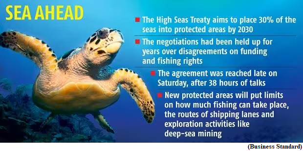
- It places “30% of the world’s oceans into protected areas, puts more money into marine conservation and covers access to and use of marine genetic resources,” as per the United Nations.
- An important negotiating point, and source of tension during the talks, was developing countries’ access to benefits reaped from the commercialisation of resources (especially genetic resources) extracted from the ocean. The treaty has agreed to setup an access- and benefit-sharing committee to frame guidelines.
- It was also underlined that activities concerning marine genetic resources of areas on high seas should be in the interests of all States and for the benefit of humanity. They have to be carried out exclusively for peaceful purposes.


